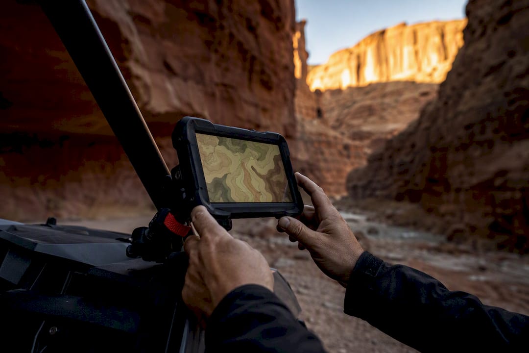
The safest, most reliable UTV GPS navigation setup for Moab pairs an offline-capable mapping app, such as onX Offroad, Gaia GPS, or Trails Offroad, with a rugged backup device or a fully charged spare phone. Download official Utah OHV overlays before you leave cell coverage, since canyon walls routinely kill signal on trails like Hell’s Revenge and Poison Spider Mesa. If you’d rather skip the setup entirely, a guided rental with built-in navigation gets you the same result with none of the prep work.
TL;DR:
- Using offline-capable mapping apps like onX Offroad or Gaia GPS with pre-downloaded maps is essential for reliable navigation in remote Moab backcountry zones.
- Smartphone apps are convenient but can struggle in extreme heat, drain batteries quickly, and perform poorly in canyon areas with signal loss, making dedicated GPS units advantageous for technical or remote routes.
- Critical features include offline tile coverage, GPX import/export, multi-GNSS accuracy, durability, and determining whether a free or paid app membership suits your riding frequency.
- Moab’s vehicle regulations require street-legal UTVs on city streets and permits for non-street-legal vehicles crossing into trails, making official overlays vital for compliance and terrain protection.
- Multi-day trips demand careful planning of fuel, water, and camp points, along with syncing waypoints and carrying backup navigation and emergency devices for canyon segments with no cell coverage.
Table of Contents
- Best Apps for UTV GPS Navigation in Moab
- Dedicated GPS Units or Smartphone Apps: Which Wins in Moab?
- What to Look for in a Moab Navigation Setup
- What Moab’s UTV Rules Mean for Your Route Planning
- Pre-Ride Checklist for UTV Navigation in Moab
- Calibrating Your GPS for Moab’s Terrain
- Handling GPS Signal Loss Between Canyon Walls
- SOS and Emergency Location Sharing for Remote Rides
- Planning a Multi-Day UTV Trip in Moab With GPS
- Match Your Navigation to Your Skill Level and Trip Goals
- Skip the Setup: Guided Rentals With Navigation Built In
- Official Maps, Permits, and Trail Guidance
- Sources
- FAQ
Best Apps for UTV GPS Navigation in Moab
Utah’s own recreation department points riders toward a short list of trusted mapping tools, and it’s worth starting there rather than guessing at app store rankings. The state’s official OHV maps page names onX Offroad, Gaia GPS, Trails Offroad, Outsiders Utah, and Polaris Ride Command as its recommended online and offline resources, and each one earns its spot for a different kind of ride.
onX Offroad stands out for public-land overlays that show exactly whose ground you’re on, a detail that matters on the boundary-heavy trails around Canyonlands. The onX Offroad app saves full map sets to your phone before you lose signal, and it offers a free two-month trial if you want to test it before committing.
Gaia GPS leans into topographic detail, which helps when you’re trying to judge elevation change on a technical climb rather than just following a line on a screen.
Trails Offroad takes a curated approach: its free tier includes 200 guided trail write ups, while the All-Access membership runs $39.99 a year and unlocks the full guide library along with offline downloads. The catch is that some guide content still requires a connection to load fully, so download what you need well before you head out.
Outsiders Utah and Polaris Ride Command round out the list, and both work best as vehicle-specific or regional supplements rather than your primary tool.
- Short, popular loops (Fins & Things, easier sections of Hell’s Revenge): a single offline app is usually enough.
- Technical scouting or unfamiliar canyon country: pair onX or Gaia with Trails Offroad’s guide detail for route confidence.
Dedicated GPS Units or Smartphone Apps: Which Wins in Moab?
Smartphones win on convenience. You already own one, the app ecosystem is huge, and switching between onX, Gaia, and a group text is effortless. But phones struggle in Moab’s summer heat, chew through battery fast when the screen stays on for navigation, and can lag when loading detailed map tiles in a dead zone.
Dedicated units like the Garmin Tread and Tread 2 close that gap. Field reviews describe the Tread 2 as rugged, multi-GNSS capable, and reliable in harsh off-road conditions, with preloaded topo and 3D maps built for exactly this kind of terrain. Mounting is straightforward, and battery life holds up far better than a phone running a screen at full brightness all day.
- Popular routes with a group and good cell backup nearby: phone app alone is fine.
- Remote or technical days: a Garmin Tread or Tread 2 as primary, phone as backup, or the reverse.
Pro Tip: Sync your GPX tracks to both devices before you leave pavement. If one battery dies mid trail, you don’t want to be re-downloading a map with zero signal.
What to Look for in a Moab Navigation Setup
- Offline tile coverage. Confirm how much area the app can store locally, and download more than you think you need, since Moab’s backcountry sprawls well beyond any single trail loop.
- Trail difficulty ratings and notes. Look for apps that show photos and rider comments, not just a line on a map, so you can match a route to your skill level before committing.
- GPX import and export. You’ll want to bring in tracks shared by other riders or export your own for a group.
- Multi-GNSS accuracy. Canyon walls bounce and block signal, so a device pulling from multiple satellite systems holds a fix better than one relying on GPS alone.
- Durability and mounting. Check IP rating, vibration resistance, and whether a solid mount and external power option exist for your specific UTV.
- Subscription versus one-time cost. Weigh a free app tier against paid memberships like Trails Offroad’s $39.99 annual plan based on how often you actually ride Moab.
What Moab’s UTV Rules Mean for Your Route Planning
Moab isn’t a free-for-all, and your navigation choices need to respect that. The City of Moab caps street-legal OHV speed at 15 mph on city streets, enforces noise limits, and requires street-legal equipment for any vehicle driving through town. A UTV that isn’t street-legal has to be trailered between the trailhead and your lodging.
Permits matter too. DiscoverMoab explains that non-resident riders need a $30 permit, valid for a year, to legally access Moab OHV trails when their vehicle isn’t street-legal in their home state. That $30 figure covers trail access, not city street driving, so check both requirements before you plan a route that crosses through town.
This is exactly why official OHV overlays matter inside your mapping app. Riding off a designated route, even by accident, damages fragile desert terrain and can result in a citation. Our guide on street-legal UTV rules in Moab breaks down which vehicles qualify and when trailering is required.
Pre-Ride Checklist for UTV Navigation in Moab
- Download before you leave town. Save offline maps and import any GPX tracks while you still have a strong signal, ideally the night before.
- Mark your key waypoints. Set the trailhead, planned exit, fuel stop, and campsite so you’re not scrambling to find them later.
- Mount and power up. Secure your device with a solid mount, bring a charged power bank, and pack a spare phone or handheld if the ride is remote.
- Track your breadcrumbs on trail. Check your line against slickrock sections conservatively, since one wrong turn on rock can mean a long walk back.
- Carry emergency backup. A satellite messenger covers you in canyon stretches with zero cell service.
Pro Tip: Slickrock rewards patience over speed. Experts note that visualizing the actual line on rock, not just following a GPS arrow, matters more than raw vehicle capability on the technical sections.
Calibrating Your GPS for Moab’s Terrain
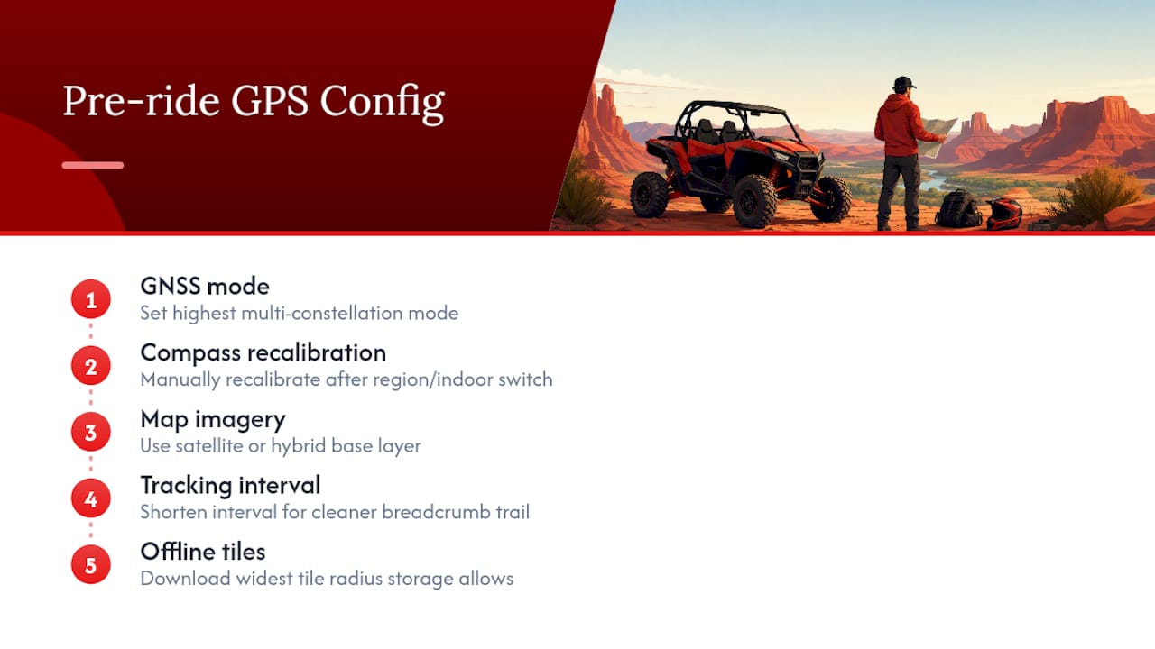
Moab’s mix of slickrock, deep canyons, and open mesa throws off GPS accuracy in ways flatter terrain never does. Before you start a ride, set your app or device to the highest available GNSS mode. Multi-constellation tracking (GPS plus GLONASS or Galileo, depending on your device) holds a fix better when sandstone walls block part of the sky.
Recalibrate your compass heading manually if your app supports it, especially after loading a new region or switching between indoor and outdoor use. A stale calibration reads a few degrees off, which doesn’t matter much on an open trail but becomes a real problem on a narrow slickrock ledge.
Set your map’s base layer to satellite or hybrid imagery rather than a simple line map when you’re scouting technical terrain. Seeing the actual rock formations helps you judge a line before you commit to it, which matters more on Moab’s exposed sections than turn-by-turn arrows ever will.
Adjust your tracking interval too. A shorter recording interval gives a cleaner breadcrumb trail through switchbacks and canyon bends, though it costs more battery. On a full-day ride, that trade-off usually favors accuracy, since a gap in your track right where the trail forks is the last thing you want.
Finally, download the widest offline tile radius your storage allows. Moab routes connect to each other more than first-time visitors expect, and a ride can drift toward the edge of your downloaded area faster than planned.
Handling GPS Signal Loss Between Canyon Walls
Canyon walls are the single biggest navigation obstacle in Moab, and they cause real signal problems, not just theoretical ones. Deep sandstone corridors block satellite line of sight, and your device can lose its fix entirely for stretches of trail, especially through narrow sections of Pritchett Canyon or the deeper cuts off Hell’s Revenge.
The fix isn’t a better signal. It’s planning for the gap before it happens. Mark waypoints at every canyon entrance and exit while you still have a fix, so your device can reconnect the dots even after losing tracking mid canyon.
Trust your downloaded offline map over live tracking when you’re between walls. An app with saved tiles keeps showing terrain and trail lines even without a satellite fix, while a device relying on live data just freezes or blanks.
Slow down through narrow sections rather than trusting a moving arrow that may be a few seconds behind reality. GPS drift is worse in canyons, and a device catching up to your actual position after you’ve already made a turn is a recipe for confusion on rock you can’t easily reverse out of.
If you’re riding with a group, designate one rider to carry a device with the widest offline coverage and treat that person’s track as the reference line whenever individual units disagree.
SOS and Emergency Location Sharing for Remote Rides
Moab’s remote stretches, particularly deep in Pritchett Canyon or the far reaches of Poison Spider Mesa, put you well outside cell coverage for hours at a time. That’s exactly where SOS integration earns its place in your setup rather than staying a nice-to-have feature buried in a menu.
Many rugged handheld units and satellite messenger add-ons let you trigger an SOS alert that transmits your exact coordinates to emergency responders even with zero cell bars. Pair that capability with your primary mapping app rather than treating it as a separate system, since responders need your live position, not just a general trail name.
Set up location sharing with someone off trail before you leave, whether that’s a family member back at your lodging or a designated contact in your group’s chat thread. A tool like CrewsCanvas’s trip planning toolkit can help a group coordinate shared waypoints and ETAs, so everyone knows where you’re supposed to be and by when.
Test your SOS feature at home before your trip. Don’t assume a satellite messenger works the way you think it does when you’re standing in a canyon with a dying battery and an injured rider. Confirm the button sequence, confirm the device is charged and paired, and confirm your emergency contact actually knows what an alert from your device looks like.
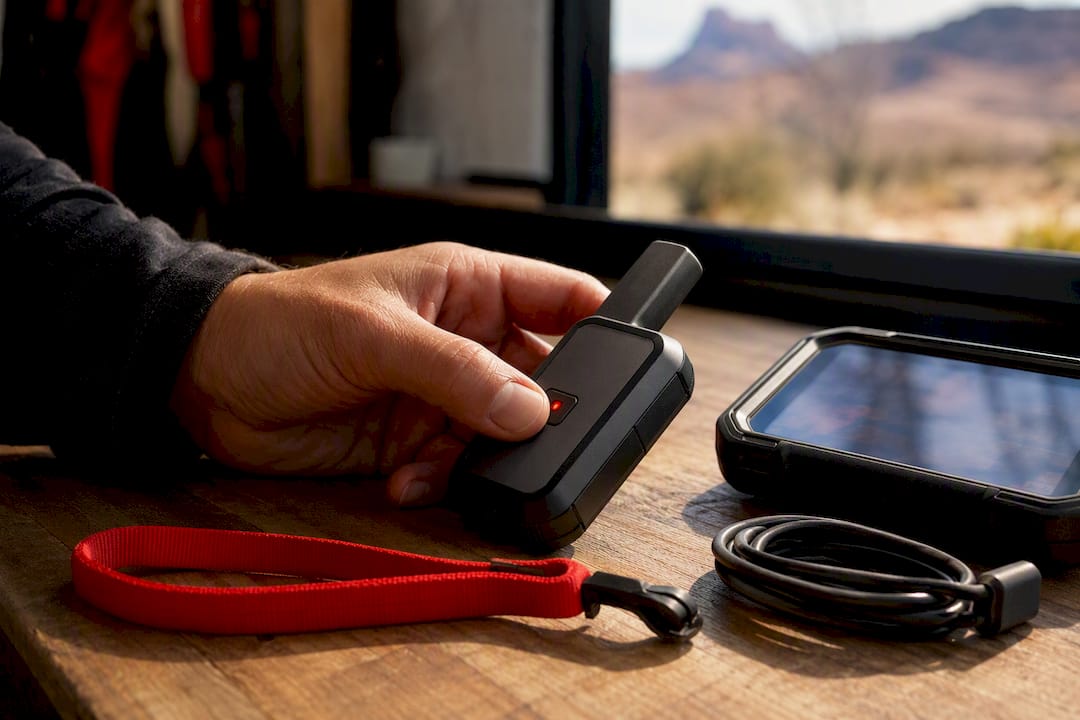
If you’re riding solo, this isn’t optional. A dedicated satellite communicator, kept separate from your phone’s battery drain, is the difference between a bad afternoon and a real emergency going unnoticed for hours.
Planning a Multi-Day UTV Trip in Moab With GPS
Multi-day Moab trips demand more from your navigation setup than a single afternoon loop, mostly because fuel, water, and daylight all become planning variables instead of afterthoughts. Start by sequencing your waypoints for the entire trip, not just each day in isolation, so you know where each night’s camp or lodging sits relative to the next day’s trailhead.
Mark fuel stops on your map before day one. Moab’s outlying trail systems can put you 30 or more miles from the nearest station, and running your tank low on remote slickrock isn’t the moment to discover that.
Build in a buffer waypoint for each day’s turnaround point, calculated by fuel range and daylight rather than trail mileage alone. Canyon terrain takes longer to cover than the same distance on flat ground, and underestimating that is one of the most common multi-day planning mistakes.
Sync your GPX tracks across every device in your group before day one, not each morning. A shared reference track means nobody’s improvising a route change solo in a canyon with no signal.
Keep a paper backup of your key waypoints and permit information for the whole trip. Batteries fail, phones drop, and a laminated card with your fuel stops and camp coordinates costs you nothing and covers the one scenario every app fails at.
Match Your Navigation to Your Skill Level and Trip Goals
A phone app works fine for short, popular routes ridden with a group. Technical slickrock or remote, multi-day terrain calls for a dedicated device, a satellite backup, or a guided tour. When you’re new to Moab, lean toward redundancy: two ways to find your way beat one every time.
— PHENYX
Skip the Setup: Guided Rentals With Navigation Built In
If everything above sounds like more prep than you want to handle on vacation, Epic4x4adventures solves it by putting navigation directly into the vehicle. Every UTV in our 2026 Polaris fleet comes with built-in GPS, so there’s no app to download, no device to mount, and no offline tiles to manage before you hit the trail.
Choose a self-drive rental and follow the built-in navigation at your own pace, or book a guided tour and let a local expert who knows every canyon wall and slickrock ledge handle the route entirely. Either way, you skip the entire GPS shopping decision this article just walked through. A damage deposit option and numerous five-star reviews reflect a fleet and support team built around getting first-time and experienced riders alike safely onto Moab’s best trails. Browse current UTV rentals or check out our full lineup of guided tours to compare which approach fits your trip.
Official Maps, Permits, and Trail Guidance
- Utah Outdoor Recreation OHV Maps: official app recommendations and offline map overlays.
- Moab City OHV Rules: street-legal requirements, speed, and noise limits.
- DiscoverMoab Off-Roading Guide: non-resident permit costs and registration basics.
- Epic 4x4 Moab Trail Maps Guide: local trail context and trip planning.
Sources
- Maps - Utah Outdoor Recreation
- OHVs In Moab | Moab, UT - Official Website
- Moab ATV trails and UTV Riding — Discover Moab, Utah
- Garmin Tread 2 review — Overland Expo Compass
FAQ
What Is the Best GPS for UTV Trail Riding in Moab?
There’s no single best option; it depends on the ride. For most riders, an offline-capable app like onX Offroad or Gaia GPS paired with a phone covers popular trails, while a rugged unit like the Garmin Tread 2 adds durability for technical or remote routes.
Can You Drive a UTV in Moab?
Yes, but the vehicle’s status determines where. Street-legal UTVs can drive on city streets under Moab’s 15 mph limit with required equipment, while non-street-legal vehicles need a $30 non-resident permit for trail access and must be trailered between locations.
What Is the Best App for UTV Trails in Utah?
Utah’s own recreation department recommends onX Offroad, Gaia GPS, Trails Offroad, Outsiders Utah, and Polaris Ride Command as trusted mapping resources. Trails Offroad’s curated guides and $39.99 annual All-Access membership work especially well for riders wanting detailed, route-specific information.
Do I Need GPS if I Book a Guided UTV Tour?
No. Epic4x4adventures’ vehicles come with built-in GPS navigation, and guided tours are led by local experts who know the terrain, so there’s nothing extra to download or configure. This suits riders who’d rather focus on the drive than the device.
What’s the Best Trail GPS App for a UTV?
For most Moab riders, onX Offroad’s offline maps and public-land overlays offer the strongest all-around fit, while Gaia GPS suits those prioritizing topographic detail. Trails Offroad works best for riders who want curated, difficulty-rated trail write-ups alongside their map.
Recommended