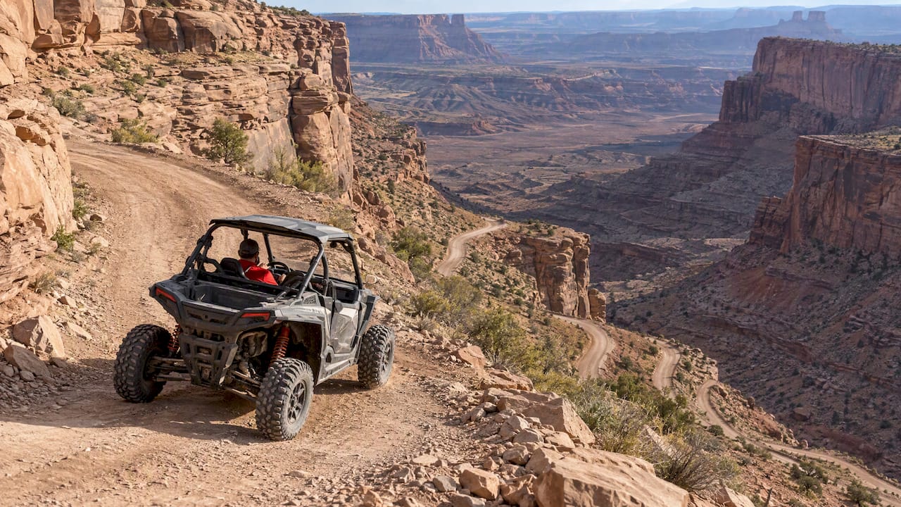
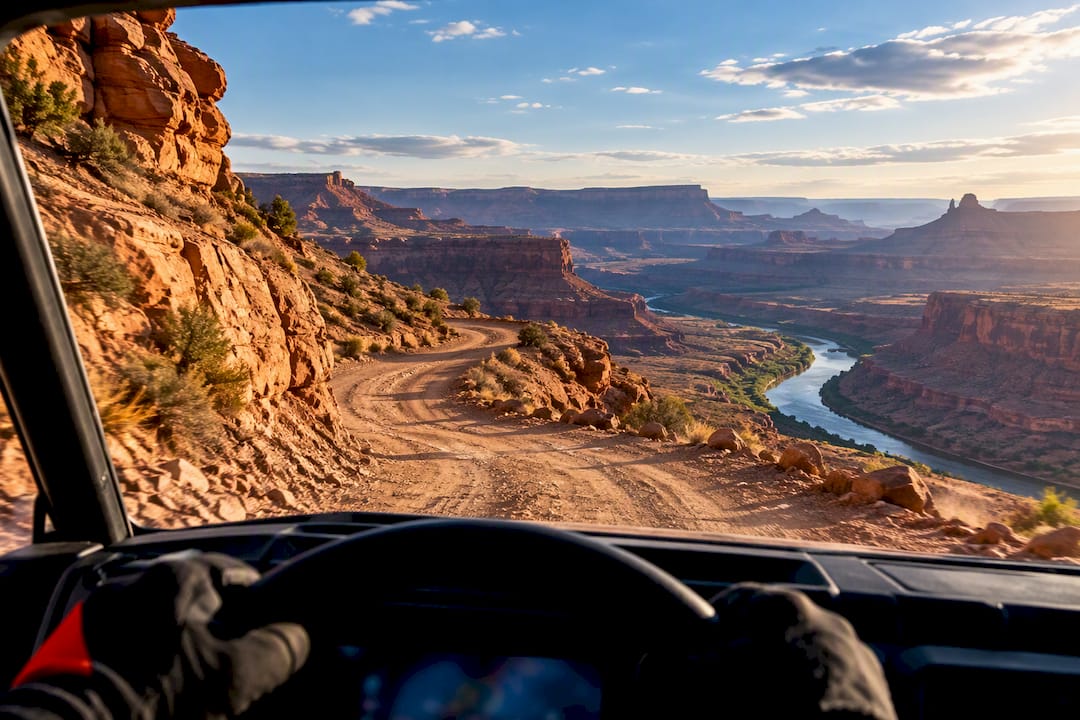
For scenery, four trails lead the pack: Hell’s Revenge rewards advanced riders with sweeping slickrock panoramas above the Colorado River; Fins and Things delivers a roller-coaster ride through sandstone waves; Hurrah Pass suits intermediate drivers chasing canyon views with less intensity; and Shafer Trail offers beginners a dramatic, switchback descent. All of these sit on BLM land, not inside Arches or Canyonlands, where recreational UTV riding is not allowed.
TL;DR:
- Trails like Hell’s Revenge and Fins and Things demand high ground clearance and aggressive tires, suitable for advanced riders on slickrock surfaces.
- Beginners and families will find Hurrah Pass and Shafer Trail more accessible, with less technical challenges and broader canyon views.
- Permits require completing a free Utah OHV education course for riders over 18 and purchasing a $35 non-resident permit, valid for 12 months.
- All recreational UTV riding takes place on BLM land, with strict restrictions within Arches and Canyonlands National Parks, and riders must stay on designated trails.
- Weather, trail conditions, and early morning or late afternoon lighting significantly affect safety, traction, and scenic photography opportunities.
Table of Contents
- Top Scenic UTV Trails at a Glance
- Trail Highlights: Facts, Hazards, and Rider Tips
- Permits, Rules, and Where You Can Legally Ride in Utah
- Vehicle, Rental, and Gear Checklist for Scenic UTV Days
- Best Seasons, Weather Cautions, and Safety Timing
- Local Provider Perspective: What a Guided Tour or Rental Day Looks Like
- Environmental Impact and Leave No Trace on Moab’s UTV Trails
- Best Times of Day for Scenic Views and Trail Conditions
- Pick Scenery Over Stunts If You Only Have One Day
- How Epic 4x4 Adventures Can Help You Ride Moab’s Best Trails
- FAQ
- Sources
Top Scenic UTV Trails at a Glance
Before you commit to a route, it helps to see how the main contenders stack up side by side. Each trail below sits on land managed by the Bureau of Land Management, and each delivers a different flavor of Moab scenery.
- Hell’s Revenge: advanced, about 6.5 miles, 2 to 3 hours, slickrock ridgelines with Colorado River overlooks, accessed through Sand Flats Recreation Area.
- Fins and Things: moderate to advanced, roughly 5 miles, 1.5 to 2 hours, tight sandstone dips and climbs with La Sal Mountain views, also reached via Sand Flats.
- Hurrah Pass: beginner to moderate, about 16 miles round trip, 2 to 3 hours, wide canyon vistas over the Colorado River, mostly graded dirt with light rock sections.
- Shafer Trail and Potash Road: beginner to moderate, around 20 miles combined, 2 to 4 hours, cliffside switchbacks dropping toward the canyon floor with red rock towers on Potash Road.
- Poison Spider Mesa: advanced, roughly 14 miles, 3 to 4 hours, mesa-top panoramas with technical ledges near the famous Portal viewpoint.
- Monitor and Merrimac: moderate, about 9 miles, 2 hours, twin sandstone butts with open desert views, a quieter alternative to the busier slickrock loops.
Hell’s Revenge and Fins and Things both demand a machine with good ground clearance and aggressive tires, since slickrock punishes underpowered setups. Hurrah Pass and Shafer Trail are friendlier to stock rental UTVs and make a solid choice if you want scenery without technical stress. Poison Spider Mesa sits closer to Hell’s Revenge in difficulty, with several optional obstacles that carry marked bypasses for riders who want the view without the risk.
Trail Highlights: Facts, Hazards, and Rider Tips
Each trail has its own personality once you’re actually on it, and a little advance knowledge saves time and trouble.
- Hell’s Revenge: access is through the Sand Flats entrance station, surface is almost entirely slickrock, and the main hazards are steep exposure and narrow ledges near the rim. Most extreme features have bypasses, so advanced riders can choose their challenge level.
- Fins and Things: same trailhead area as Hell’s Revenge, slickrock surface with repeated dips that feel like a roller coaster, and the hazard here is losing traction on a climb rather than exposure.
- Hurrah Pass: accessed from Kane Creek Road south of town, graded dirt and gravel with rock sections near the pass itself, and the main hazard is narrow shelf road with oncoming traffic.
- Shafer Trail and Potash Road: accessed near the Island in the Sky entrance, hazards include tight switchbacks and loose gravel on the descent.
- Poison Spider Mesa: accessed off Highway 279, mixed sand and slickrock, with hazards concentrated at a few named ledges that have long been obstacles for stock vehicles.
Facilities are minimal on every one of these routes. Expect no water, no restrooms, and spotty or nonexistent cell coverage once you’re past the trailhead, so plan accordingly before you leave pavement.
Pro Tip: Slickrock trails often share painted trail markers with mountain bike routes, so don’t assume every dash is meant for motorized traffic; yield to cyclists and hikers wherever paths cross.
Permits, Rules, and Where You Can Legally Ride in Utah
Utah requires every OHV operator age 18 and older to complete a free online OHV education course at least once in a lifetime, and the course takes under 30 minutes to finish. Riders under 18 need a separate youth safety course, and it’s smart to carry your completion certificate while riding in case a ranger asks.
- Visitors bringing their own machine into Utah need a non-resident OHV permit, which typically costs $35 per machine and stays valid for 12 months.
- Permits and registration apply per vehicle, so a group trip means one permit for each UTV or ATV in the party.
- Recreational UTV and ATV riding is prohibited inside Arches National Park and Canyonlands National Park; scenic off-road routes around Moab sit on BLM land like Sand Flats and the Kane Creek corridor instead.
Always check posted signage at the trailhead, since jurisdiction can shift within a few miles and fines follow riders who cross into restricted park boundaries without realizing it.
Vehicle, Rental, and Gear Checklist for Scenic UTV Days
Trails like Hell’s Revenge and Poison Spider Mesa call for a UTV with real ground clearance, four-wheel drive, and tires in the 30 to 33 inch range. Hurrah Pass and Shafer Trail are more forgiving and work fine with a standard rental setup.
- Ask any rental company about its damage-deposit policy, what insurance or assurance coverage is included, and whether the vehicle has built-in GPS navigation.
- Confirm whether trail entry fees are included in the rental price or billed separately at the Sand Flats gate.
- Ask what emergency support looks like if you break down miles from pavement with no cell signal.
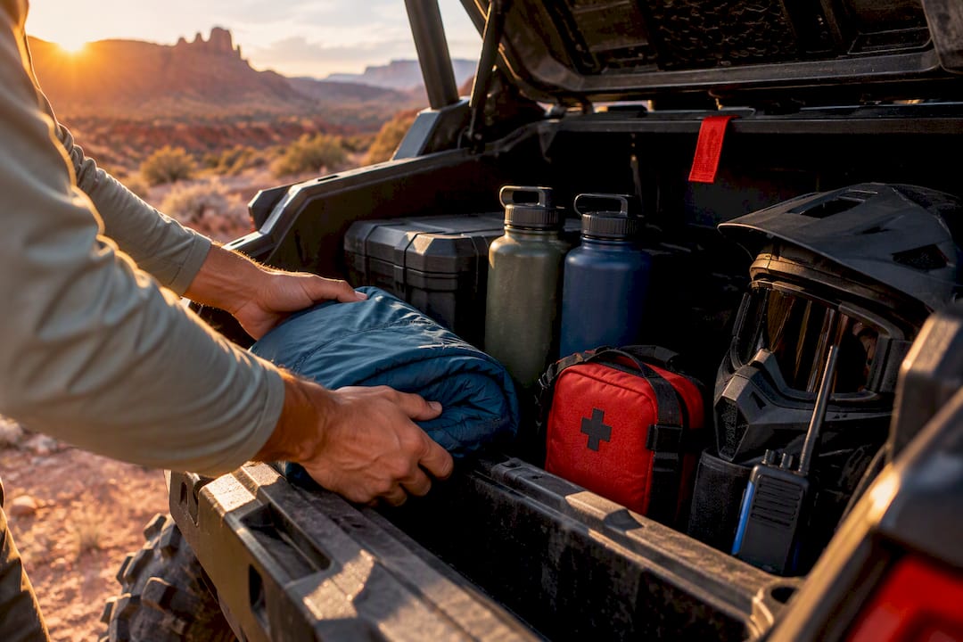
Pack at least one gallon of water per person per day, sun protection, a basic first-aid kit, tow straps, a tire repair kit, and a charged battery pack. Treat limited cell coverage as the default, not the exception, and have a plan for reaching help if something goes wrong.
Pro Tip: Airing down your tires slightly improves traction on sand and slickrock, and skipping slickrock altogether after rain avoids one of the most common causes of UTV accidents in the area.
Best Seasons, Weather Cautions, and Safety Timing
Spring and fall offer the most comfortable riding temperatures and the clearest light for photos across red rock country. Summer rides are still doable, but an early start beats the heat and gives you a real hydration buffer before afternoon temperatures peak.
- Check current weather and trail conditions before you leave, since slickrock becomes genuinely dangerous when wet and some routes turn impassable after storms.
- Build in extra time beyond the trail’s stated duration, since photo stops and slower sections add up quickly.
- Leave your itinerary with someone back at your lodging and carry basic recovery gear in case of a breakdown or flat tire far from help.
Local Provider Perspective: What a Guided Tour or Rental Day Looks Like
Professional operators in Moab typically run a safety briefing before departure, outline vehicle controls, and pair riders with a machine suited to their chosen trail. Guided tours led by local guides who know the terrain, along with vehicles carrying built-in navigation, remove a layer of risk for first-time visitors. A guided option tends to fit novice riders, families, and travelers short on time better than a self-drive rental into unfamiliar terrain.
Environmental Impact and Leave No Trace on Moab’s UTV Trails
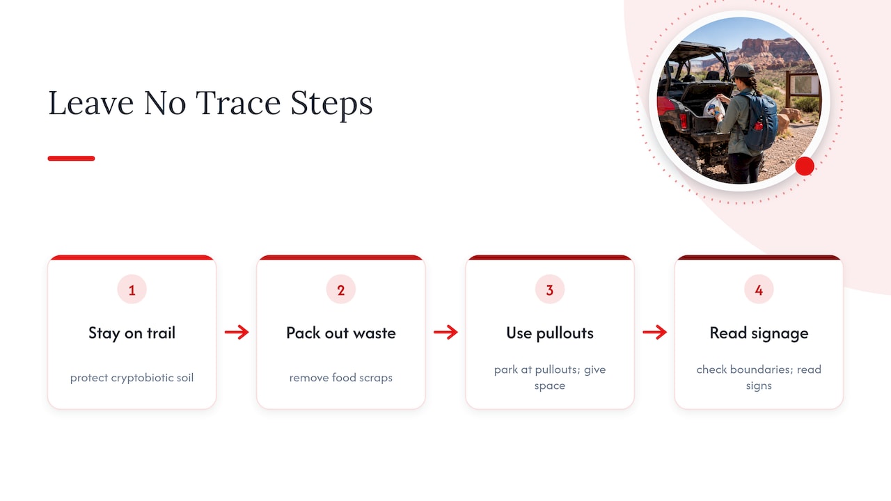
Moab’s slickrock and desert soils look tough but recover slowly from damage. Driving off marked routes crushes cryptobiotic soil crusts, a living layer that can take decades to regrow once broken, and that crust holds the desert floor together against erosion.
Staying on the designated trail protects more than scenery. It keeps fragile plant life intact and prevents new braided tracks from spreading across open desert, which is a common problem wherever riders cut corners on wide, open sections like Hurrah Pass or Monitor and Merrimac.
Pack out everything you bring in, including food scraps, since wildlife in this region struggles with human food waste. Stick to established pullouts for breaks rather than parking on open slickrock or sand, and give wildlife space if you spot bighorn sheep or other animals near the trail corridor.
Respecting posted boundaries between BLM land and the adjacent national parks does double duty. It keeps you compliant with Utah OHV rules and protects areas that see heavier foot traffic and more sensitive management under National Park Service rules. A short pause to read trailhead signage before you start costs a few minutes and prevents most unintentional violations.
Best Times of Day for Scenic Views and Trail Conditions
Early morning light tends to produce the sharpest contrast on Moab’s red rock, with low-angle sun carving shadows into slickrock formations on routes like Hell’s Revenge and Fins and Things. Riding before mid-morning also means cooler temperatures, which matters most from late May through September.
Late afternoon offers a second good window, especially on west-facing sections of Potash Road and Shafer Trail, where canyon walls catch warm light before sunset. Midday sun flattens the landscape and intensifies heat, so it’s the least rewarding time for both photos and comfort.
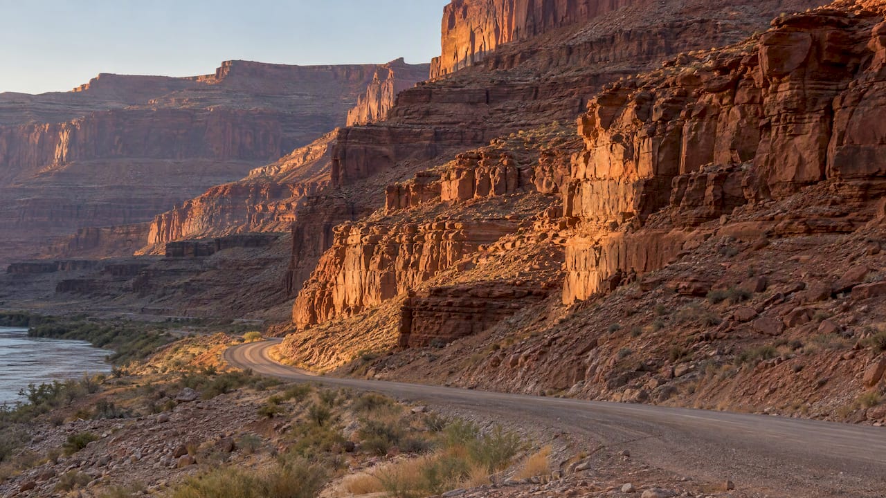
Trail surfaces also shift with the clock. Slickrock gains grip as it dries out after any overnight moisture, so a short delay after sunrise can actually improve traction on routes where dew collects. Afternoon storms are common in summer, so a morning start keeps you ahead of weather that often builds by early afternoon.
Pick Scenery Over Stunts If You Only Have One Day
A single day in Moab goes further when you choose one scenic trail done well rather than chasing every technical feature on the map. Save the hardest obstacles for a guided run or a return trip once you know the terrain, and treat marked boundaries between BLM and National Park Service land as firm, not optional.
— PHENYX
How Epic 4x4 Adventures Can Help You Ride Moab’s Best Trails
We run a fleet of vehicles built with navigation already wired in, so you’re never guessing which fork leads to Hell’s Revenge or Hurrah Pass. We offer a damage deposit option that can ease your worries before you even leave the lot, and our local guides know these trails well enough to point out the overlook you’d otherwise drive past.
Novices, families, and travelers short on time tend to get the most out of a guided tour, while confident riders with some off-road experience often prefer a self-drive rental with our built-in navigation handling the route-finding. Browse our UTV rentals or check available guided tours to find the fit for your trip.
FAQ
What are the best trails in Moab for UTVs?
Hell’s Revenge and Fins and Things lead for advanced riders chasing slickrock scenery, while Hurrah Pass and Shafer Trail suit beginners and families who want big views with less technical demand. All of them sit on BLM land rather than inside the national parks.
What is the best side-by-side for trail riding in Moab?
A UTV with strong ground clearance, four-wheel drive, and tires in the 30 to 33 inch range handles slickrock routes like Hell’s Revenge comfortably. A standard rental UTV works fine for gentler routes like Hurrah Pass or Shafer Trail.
What is the most scenic trail in Moab?
Hell’s Revenge is widely considered the standout for scenery, with roughly 6.5 miles of slickrock ridgelines overlooking the Colorado River, according to the BLM’s Hell’s Revenge trailhead guidance. Hurrah Pass and Shafer Trail come close with their own canyon and cliffside views.
Can you drive a UTV in Moab?
Yes, but only on designated routes managed by the BLM, such as Sand Flats and the trails it accesses. Recreational UTV and ATV riding is not allowed inside Arches National Park or Canyonlands National Park.
Do I need a permit to ride a UTV in Moab?
Utah requires a free OHV education course for riders 18 and older, and visitors bringing their own machine need a non-resident OHV permit that typically costs $35 and lasts 12 months.
Sources
- OHV Education - Utah Outdoor Recreation
- Sand Flats Recreation Area - Bureau of Land Management
- Compendium — Arches National Park
Recommended